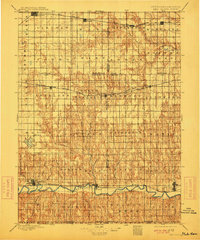
1897 Map of Red Cloud
USGS Topo · Published 1913About this map
The Republican River valley forms the southern anchor of this 1890s survey, showing the agricultural and rail development of the Nebraska-Kansas border region. Early settlements like Red Cloud, Riverton, and Franklin are firmly established along the river corridor, while the northern sections of the map document the expansion of rail-centered commerce at Minden and Roseland. The landscape is a network of township boundaries and tributary waters such as Thompson Creek and the Little Blue River.
Find a feature on this map
56 named features on this map. Tap any name to fly to it.
Don’t see what you’re looking for? This feature index may not catch every label — zoom into the map to look around manually.
Map Details
Editions of this 1897 Red Cloud Map
4 editions found
Other maps of this area

1893 · Smith Center
USGS Topo · 1:125,000

1893 · Phillipsburg
USGS Topo · 1:125,000

1894 · Mankato
USGS Topo · 1:125,000

1894 · Kenesaw
USGS Topo · 1:62,500

1894 · Kearney
USGS Topo · 1:62,500

1894 · Minden
USGS Topo · 1:62,500

1896 · Holdrege
USGS Topo · 1:125,000

1896 · Kearney
USGS Topo · 1:125,000

1896 · Wood River
USGS Topo · 1:125,000

1897 · Red Cloud
USGS Topo · 1:125,000