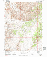
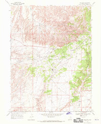
1968 Map of Red Wash
USGS Topo · Published 1985About this map
Industrial development and energy extraction dominate the landscape of Uintah County in this mid-century record. The Red Wash Oil and Gas Field and the Walker Hollow Oil and Gas Field are the primary features, characterized by a dense network of wells, power lines, and both buried and aboveground pipelines. The small settlement of Red Wash serves as the hub for these operations, situated near the transition between the rugged topography and the flatter expanses of Deadman Bench.
Find a feature on this map
15 named features on this map. Tap any name to fly to it.
Don’t see what you’re looking for? This feature index may not catch every label — zoom into the map to look around manually.
Map Details
Editions of this 1968 Red Wash Map
2 editions found
Other maps of this area

1885 · Ashley
USGS Topo · 1:250,000

1907 · Jensen
USGS Topo · 1:125,000

1910 · Jensen
USGS Topo · 1:125,000

1954 · Vernal
USGS Topo · 1:250,000

1958 · Vernal
USGS Topo · 1:250,000

1960 · Vernal
USGS Topo · 1:250,000
1965 · Rasmussen Hollow
USGS Topo · 1:24,000
1965 · Jensen
USGS Topo · 1:24,000
1968 · Red Wash SE
USGS Topo · 1:24,000
1968 · Red Wash
USGS Topo · 1:24,000