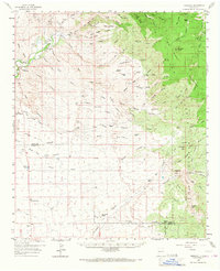
1959 Map of Redrock
USGS Topo · Published 1967About this map
The Gila River cuts through this high-desert landscape in southwestern New Mexico, where the settlement of Redrock serves as a hub for scattered ranching operations. The area is defined by its complex network of canyons and peaks, including the prominent Big Burro Mountains and the distinctive profile of Knight Peak. For local historians and genealogists, the map reveals the locations of several family-held lands such as the Jim Cureton Ranch, Van Meter Ranch, and McCauley Ranch. Evidence of earlier inhabitants is noted at the Old Indian Village (Site) and the Redrock Cem. The region's mining legacy is visible through numerous sites like the Grey Eagle Mine, Jennie Mines, and Humming Bird Mine, while the infrastructure of windmills and tanks, such as Turner Windmill and Double Tanks, illustrates the critical importance of water management in this arid environment.
Find a feature on this map
93 named features on this map. Tap any name to fly to it.
Don’t see what you’re looking for? This feature index may not catch every label — zoom into the map to look around manually.
Map Details
Editions of this 1959 Redrock Map

Other maps of this area

1909 · Silver City
USGS Topo · 1:125,000

1949 · Circle Mesa
USGS Topo · 1:24,000

1950 · Wind Mountain
USGS Topo · 1:24,000

1950 · Burro Peak
USGS Topo · 1:24,000

1951 · Circle Mesa
USGS Topo · 1:24,000

1951 · Big Burro Mountains
USGS Topo · 1:24,000

1951 · Wind Mountain
USGS Topo · 1:24,000

1954 · Silver City
USGS Topo · 1:250,000

1958 · Silver City
USGS Topo · 1:250,000

1959 · Steeple Rock
USGS Topo · 1:62,500