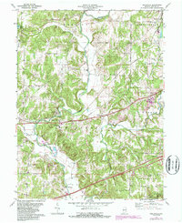
1971 Map of Reelsville
USGS Topo · Published 1987About this map
Big Walnut Creek carves a winding path through this portion of Putnam County, defining the rural character of a landscape marked by historic spans and early Indiana transportation routes. The map records several notable landmarks of local engineering, including the Houck Covered Bridge and the Manhattan Covered Bridge, which served the local farming communities of Reelsville and Manhattan. To the south, the terrain descends toward the waters of Cagles Mill Lake and the Lieber State Rec Area, reflecting mid-century water management and recreation developments.
Find a feature on this map
37 named features on this map. Tap any name to fly to it.
Don’t see what you’re looking for? This feature index may not catch every label — zoom into the map to look around manually.
Map Details
Editions of this 1971 Reelsville Map
4 editions found
Other maps of this area

1908 · Clay City
USGS Topo · 1:48,000

1910 · Clay City
USGS Topo · 1:62,500

1950 · Brazil East
USGS Topo · 1:24,000

1951 · Clinton Falls
USGS Topo · 1:24,000

1951 · Mansfield
USGS Topo · 1:24,000

1952 · Reelsville
USGS Topo · 1:24,000

1953 · Indianapolis
USGS Topo · 1:250,000

1956 · Indianapolis
USGS Topo · 1:250,000

1956 · Cloverdale
USGS Topo · 1:24,000

1956 · Cataract
USGS Topo · 1:24,000