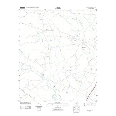
2011 Map of Reevesville
USGS Topo · Published 2011About this map
Reevesville and the surrounding agricultural landscapes of Dorchester County define this coastal plain quadrangle. The town itself serves as a central hub, while the outlying areas are dotted with smaller settlements like Sugar Hill and Dorange. The geography is heavily influenced by the meandering Edisto River, which carves through the southwestern portion of the map, joined by numerous tributaries such as Cattle Creek and Cowtail Creek. Notable landmarks include several family and community burial sites like Magnolia Cemetery and Appleby Cemetery, providing valuable data for genealogists tracing local lineages. The distinctive Cat Hole along the river and the presence of numerous named branches, such as Brickhouse Branch and Mill Branch, illustrate a terrain where drainage and water access have long dictated the patterns of rural South Carolina life.
Find a feature on this map
99 named features on this map. Tap any name to fly to it.
Don’t see what you’re looking for? This feature index may not catch every label — zoom into the map to look around manually.
Map Details
Editions of this 2011 Reevesville Map
This is the sole edition of this map. No revisions or reprints were ever made.
Other maps of this area

1919 · Lodge
USGS Topo · 1:62,500

1920 · Bowman
USGS Topo · 1:48,000

1920 · Lodge
USGS Topo · 1:48,000

1920 · Orangeburg
USGS Topo · 1:48,000

1920 · St. George
USGS Topo · 1:48,000

1921 · Orangeburg
USGS Topo · 1:62,500

1921 · Lodge
USGS Topo · 1:62,500

1921 · Bowman
USGS Topo · 1:62,500

1921 · St. George
USGS Topo · 1:62,500

1943 · Bowman
USGS Topo · 1:62,500