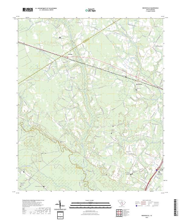
2024 Map of Reevesville
USGS Topo · Published 2024About this map
Reevesville and the nearby settlement of Dorange anchor this South Carolina landscape, which is defined by the winding course of the Edisto River along the southern border. The terrain is marked by numerous low-lying waterways, including Polk Swamp, Cattle Creek, and Cowtail Creek, which influence the local road network. The area’s genealogical record is well-preserved through numerous family and congregational burial grounds, such as Thompsons Cem, Beulah Cem, and the Whitestone Church Graveyard. The influence of the rail corridor is evident along Railroad Ave in Reevesville, while the surrounding rural landscape is divided among several counties, as indicated by the Orangeburg Co Dorchester Co and Dorchester Co Colleton Co boundary lines. Small spiritual and community centers like the Bethel Number 2 Holiness Church and Harvey Chapel Baptist Church Cem serve as focal points for the dispersed population throughout the quadrangle.
Find a feature on this map
108 named features on this map. Tap any name to fly to it.
Don’t see what you’re looking for? This feature index may not catch every label — zoom into the map to look around manually.
Map Details
Editions of this 2024 Reevesville Map
This is the sole edition of this map. No revisions or reprints were ever made.
Other maps of this area

1919 · Lodge
USGS Topo · 1:62,500

1920 · Bowman
USGS Topo · 1:48,000

1920 · Lodge
USGS Topo · 1:48,000

1920 · Orangeburg
USGS Topo · 1:48,000

1920 · St. George
USGS Topo · 1:48,000

1921 · Orangeburg
USGS Topo · 1:62,500

1921 · Lodge
USGS Topo · 1:62,500

1921 · Bowman
USGS Topo · 1:62,500

1921 · St. George
USGS Topo · 1:62,500

1943 · Bowman
USGS Topo · 1:62,500