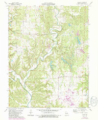
1975 Map of Reform
USGS Topo · Published 1986About this map
The winding course of Auxvasse Creek dominates this Callaway County landscape during the mid-1970s, carving through a region defined by agricultural uplands and technical infrastructure. The small settlement of Reform serves as a local anchor, situated near a cluster of community landmarks including the Church of God and Holiness Cem. To the southeast, the landscape transitions toward industrial and utility use, notably marked by a Substa and an Atmospheric Test Tower near the Missouri-Kansas-Texas line.
Find a feature on this map
35 named features on this map. Tap any name to fly to it.
Don’t see what you’re looking for? This feature index may not catch every label — zoom into the map to look around manually.
Map Details
Editions of this 1975 Reform Map
2 editions found
Other maps of this area

1890 · Fulton
USGS Topo · 1:125,000

1928 · Fulton
USGS Topo · 1:62,500

1931 · Fulton
USGS Topo · 1:62,500

1935 · Morrison
USGS Topo · 1:48,000

1940 · Montgomery City
USGS Topo · 1:62,500

1942 · Montgomery City
USGS Topo · 1:62,500

1942 · Morrison
USGS Topo · 1:62,500

1945 · Mokane
USGS Topo · 1:62,500

1945 · Morrison
USGS Topo · 1:62,500

1949 · Saint Louis
USGS Topo · 1:250,000