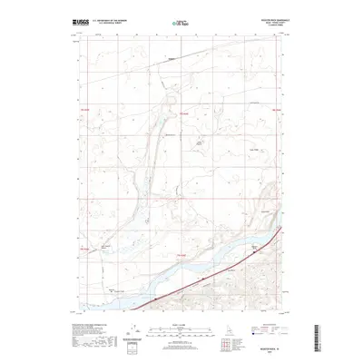
2020 Map of Register Rock
USGS Topo · Published 2020About this map
Register Rock stands as a primary landmark along the southern edge of this landscape, overlooking the wide expanse of Lake Walcott and the winding course of Rock Cr. The topography is defined by the unique volcanic and alluvial formations of Power County, including the distinctive peaks of Janies Nipples and the elevated reach of Cedar Ridge. The map details a transition from the riparian environment of the Bonanza Bar and Frymier Field along the riverbanks to the more arid upland geography of the north.
Find a feature on this map
29 named features on this map. Tap any name to fly to it.
Don’t see what you’re looking for? This feature index may not catch every label — zoom into the map to look around manually.
Map Details
Editions of this 2020 Register Rock Map
This is the sole edition of this map. No revisions or reprints were ever made.
Other maps of this area

1934 · American Falls
USGS Topo · 1:62,500

1934 · Rockland
USGS Topo · 1:62,500

1936 · American Falls
USGS Topo · 1:62,500

1937 · Rockland
USGS Topo · 1:62,500

1954 · Pocatello
USGS Topo · 1:250,000

1958 · Pocatello
USGS Topo · 1:250,000

1959 · Yale
USGS Topo · 1:62,500
1971 · American Falls SW
USGS Topo · 1:24,000
1971 · Neeley
USGS Topo · 1:24,000

1971 · Rockland West
USGS Topo · 1:24,000