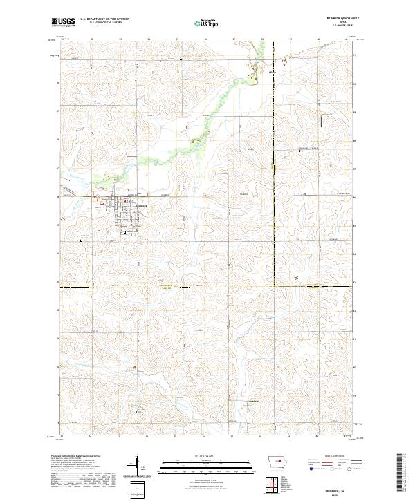
2022 Map of Reinbeck
USGS Topo · Published 2022About this map
Reinbeck sits at the heart of this agricultural landscape where the borders of Grundy, Black Hawk, and Tama counties converge. The town's grid is well-defined by landmarks such as Reinbeck Cem and the surrounding farmland is etched by the meandering courses of Black Hawk Creek and Twelvemile Cr. To the south, the smaller settlement of Dinsdale and the Grant Township Cem provide specific points of interest for those tracing rural heritage in the region.
Find a feature on this map
46 named features on this map. Tap any name to fly to it.
Don’t see what you’re looking for? This feature index may not catch every label — zoom into the map to look around manually.
Map Details
Editions of this 2022 Reinbeck Map
This is the sole edition of this map. No revisions or reprints were ever made.
Other maps of this area

1954 · Waterloo
USGS Topo · 1:250,000

1955 · Waterloo
USGS Topo · 1:250,000

1963 · Buckingham
USGS Topo · 1:24,000

1963 · Hudson
USGS Topo · 1:24,000

1971 · Gladbrook NE
USGS Topo · 1:24,000

1971 · Zaneta
USGS Topo · 1:24,000

1971 · Dike
USGS Topo · 1:24,000

1971 · Lincoln
USGS Topo · 1:24,000

1971 · Traer
USGS Topo · 1:24,000

1971 · Reinbeck
USGS Topo · 1:24,000