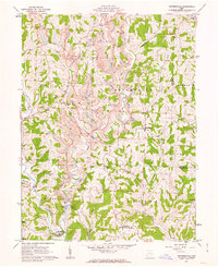
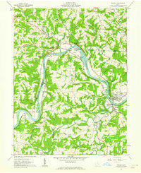
1961 Map of Reinersville
USGS Topo · Published 1963About this map
The hills and hollows of Morgan and Noble counties show a landscape defined by traditional rural settlements and modern heavy industry in the early 1960s. Small community centers like Reinersville and Bristol remain the heart of local life, anchored by numerous country houses of worship including Bristol Ch, Lebanon Ch, and Crossroads Ch. Educational history is preserved through sites such as Bristol Sch and Center Sch, while genealogy researchers will find several family-named burial grounds like Kildow Cem and Robinson Cem.
Find a feature on this map
50 named features on this map. Tap any name to fly to it.
Don’t see what you’re looking for? This feature index may not catch every label — zoom into the map to look around manually.
Map Details
Editions of this 1961 Reinersville Map
4 editions found
Other maps of this area

1909 · Caldwell
USGS Topo · 1:62,500

1910 · Philo
USGS Topo · 1:62,500

1910 · Mc Connelsville
USGS Topo · 1:62,500

1911 · Cumberland
USGS Topo · 1:62,500

1912 · Caldwell
USGS Topo · 1:62,500

1949 · Clarksburg
USGS Topo · 1:250,000

1956 · Clarksburg
USGS Topo · 1:250,000

1961 · Clarksburg
USGS Topo · 1:250,000
1961 · Beverly
USGS Topo · 1:24,000

1961 · Mc Connelsville
USGS Topo · 1:24,000