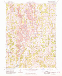
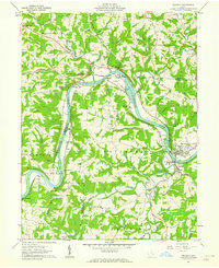
1961 Map of Reinersville
USGS Topo · Published 1969About this map
The hills and hollows of Morgan and Noble counties are heavily scarred by industrial activity in the early 1960s, most notably by the extensive Strip Mines that dominate the landscape between Bristol and Manchester. These mining operations, alongside scattered oil wells and gas wells, define the local economy of the era, punctuated by settling ponds and conveyor systems. Despite this heavy industry, rural life persists in small hamlets like Reinersville and Hackney.
Find a feature on this map
44 named features on this map. Tap any name to fly to it.
Don’t see what you’re looking for? This feature index may not catch every label — zoom into the map to look around manually.
Map Details
Editions of this 1961 Reinersville Map
4 editions found
Other maps of this area

1909 · Caldwell
USGS Topo · 1:62,500

1910 · Philo
USGS Topo · 1:62,500

1910 · Mc Connelsville
USGS Topo · 1:62,500

1911 · Cumberland
USGS Topo · 1:62,500

1912 · Caldwell
USGS Topo · 1:62,500

1949 · Clarksburg
USGS Topo · 1:250,000

1956 · Clarksburg
USGS Topo · 1:250,000

1961 · Clarksburg
USGS Topo · 1:250,000
1961 · Beverly
USGS Topo · 1:24,000

1961 · Mc Connelsville
USGS Topo · 1:24,000