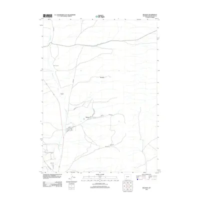
2012 Map of Reliance
USGS Topo · Published 2012About this map
Reliance serves as the primary hub of this 2012 survey in Sweetwater County, with its grid of streets including N St, S St, and 4th St organized south of Reliance Rd. The drainage of Killpecker Cr defines the north-south axis of the landscape, flanked by a network of industrial and access routes. Transport history is etched into the topography through junctions like Winton Junction and Stansbury Junction, which connect the scattered settlements of Stansbury to the larger regional infrastructure. The presence of East Plane near Lionkol Rd suggests the historical industrial footprint of the area, while the southern portion of the map shows residential development along Yellowstone Rd and Dines Way. This modern topographical study captures the evolution of these coal-country settlements as they transition into the 21st century.
Find a feature on this map
23 named features on this map. Tap any name to fly to it.
Don’t see what you’re looking for? This feature index may not catch every label — zoom into the map to look around manually.
Map Details
Editions of this 2012 Reliance Map
This is the sole edition of this map. No revisions or reprints were ever made.
Other maps of this area

1908 · Rock Springs
USGS Topo · 1:62,500

1910 · Rock Springs
USGS Topo · 1:62,500

1954 · Rock Springs
USGS Topo · 1:250,000

1958 · Rock Springs
USGS Topo · 1:250,000

1958 · Boars Tusk
USGS Topo · 1:62,500

1961 · Pilot Butte
USGS Topo · 1:24,000

1961 · Kanda
USGS Topo · 1:24,000

1962 · Rock Springs
USGS Topo · 1:250,000

1968 · North Baxter
USGS Topo · 1:24,000
1968 · Clay Buttes SE
USGS Topo · 1:24,000