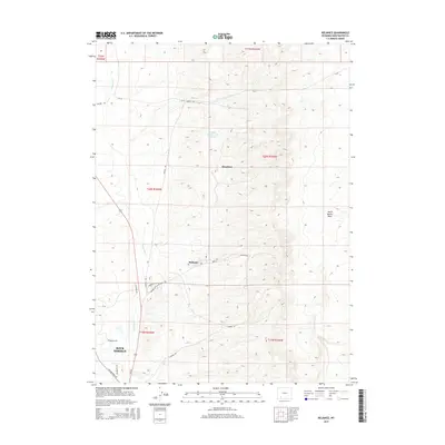
2015 Map of Reliance
USGS Topo · Published 2015About this map
Reliance and Stansbury occupy the central valley of this Sweetwater County survey, where the industrial legacy of the region is written into the landscape. The northern portion of the map is dominated by the Number 1 Tailings Pond Reservoir, reflecting the intensive mining and resource extraction history that fueled the growth of nearby Rock Springs. The local transport network is defined by a series of specialized routes like Winton Rd and Lionkol Rd, which weave through the high desert terrain to connect these former company towns. To the east, the North Baxter Basin provides a geological counterpoint to the narrow corridor formed by Killpecker Cr, which drains the western sections of the quadrangle. This 2015 study documents the contemporary footprint of these high-altitude communities as they transition from their origins as coal-mining camps into the modern era.
Find a feature on this map
28 named features on this map. Tap any name to fly to it.
Don’t see what you’re looking for? This feature index may not catch every label — zoom into the map to look around manually.
Map Details
Editions of this 2015 Reliance Map
This is the sole edition of this map. No revisions or reprints were ever made.
Other maps of this area

1908 · Rock Springs
USGS Topo · 1:62,500

1910 · Rock Springs
USGS Topo · 1:62,500

1954 · Rock Springs
USGS Topo · 1:250,000

1958 · Rock Springs
USGS Topo · 1:250,000

1958 · Boars Tusk
USGS Topo · 1:62,500

1961 · Pilot Butte
USGS Topo · 1:24,000

1961 · Kanda
USGS Topo · 1:24,000

1962 · Rock Springs
USGS Topo · 1:250,000

1968 · North Baxter
USGS Topo · 1:24,000
1968 · Clay Buttes SE
USGS Topo · 1:24,000