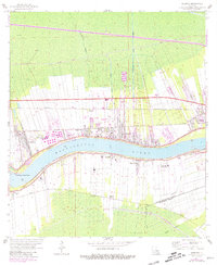
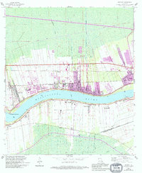
1962 Map of Reserve
USGS Topo · Published 1981About this map
Mississippi River frontage defines the development of St. John the Baptist Parish in the early 1960s, where traditional riverfront estates like San Francisco Plantation and Gold Mine Plantation contrast with industrial and transportation growth. The landscape is heavily structured by river proximity, with the Kansas City Southern, Illinois Central, and Texas and Pacific railroads running parallel to the banks to serve riverfront communities.
Find a feature on this map
30 named features on this map. Tap any name to fly to it.
Don’t see what you’re looking for? This feature index may not catch every label — zoom into the map to look around manually.
Map Details
Editions of this 1962 Reserve Map
5 editions found
Other maps of this area

1891 · Hahnville
USGS Topo · 1:62,500

1892 · Lac Des Allemands
USGS Topo · 1:62,500

1892 · Mount Airy
USGS Topo · 1:62,500

1892 · Bonnet Carre
USGS Topo · 1:62,500

1932 · Lac Des Allemands NW
USGS Topo · 1:31,680

1932 · Hahnville NW
USGS Topo · 1:31,680

1932 · Lac Des Allemands NE
USGS Topo · 1:31,680

1935 · Laplace
USGS Topo · 1:31,680

1936 · Hahnville
USGS Topo · 1:31,680

1936 · Ruddock
USGS Topo · 1:31,680