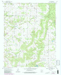
1970 Map of Rhea
USGS Topo · Published 1983About this map
Norwood Prairie and the surrounding timberlands of the Ozark National Forest define this 1970 landscape on the border of Benton and Washington Counties. The settlement at Norwood serves as a local hub, featuring the Norwood Ch and the Norwood Community Hall. To the south and east, the terrain rises toward Weddington Mountain, where Weddington Gap provides passage through the high ground. Numerous water sources, including Chambers Spring and Roaring Spring, feed the drainages of Spring Creek and Weddington Creek. Genealogists will find the locations of family-named landmarks such as Beatty Cem and Crawford Cem preserved here. The map also records early recreational and industrial footprints, from the namesake settlement of Rhea to the waters of Lincoln Lake and Lake Weddington.
Find a feature on this map
28 named features on this map. Tap any name to fly to it.
Don’t see what you’re looking for? This feature index may not catch every label — zoom into the map to look around manually.
Map Details
Editions of this 1970 Rhea Map
3 editions found
Other maps of this area

1898 · Tahlequah
USGS Topo · 1:125,000

1898 · Winslow
USGS Topo · 1:125,000

1899 · Fayetteville
USGS Topo · 1:125,000

1899 · Siloam Springs
USGS Topo · 1:125,000

1901 · Winslow
USGS Topo · 1:125,000

1901 · Fayetteville
USGS Topo · 1:125,000

1901 · Tahlequah
USGS Topo · 1:125,000

1903 · Siloam Springs
USGS Topo · 1:125,000

1904 · Siloam Springs
USGS Topo · 1:125,000

1904 · Fayetteville
USGS Topo · 1:125,000