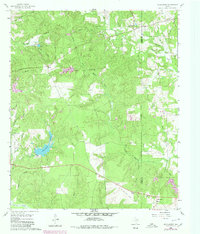
1960 Map of Rhonesboro
USGS Topo · Published 1980About this map
Rhonesboro sits at the southern edge of this East Texas terrain, where the undulating landscape is defined by the headwaters of the Little Cypress Creek system. The area reflects a rural economy transitioning from early 20th-century rail dependencies to modern infrastructure, evidenced by the presence of an Old Railroad Grade and numerous pipelines cutting across the timbered tracts. Local history and genealogy are anchored by landmarks like Little Hope Ch, Smith Cem, and Rogers Cem, alongside small crossroads communities like Perryville and Ogburn. Water resources are central to the map's character, featuring diverse named bodies such as Gunstream Lakes, Johnson Lake, and the winding Caney Creek. These features, along with scattered Gravel Pits, highlight a landscape shaped by both natural drainage and local extractive industry.
Find a feature on this map
37 named features on this map. Tap any name to fly to it.
Don’t see what you’re looking for? This feature index may not catch every label — zoom into the map to look around manually.
Map Details
Editions of this 1960 Rhonesboro Map
4 editions found
Other maps of this area

1956 · Tyler
USGS Topo · 1:250,000

1960 · Shady Grove
USGS Topo · 1:24,000

1960 · Pritchett
USGS Topo · 1:24,000

1960 · Hainesville
USGS Topo · 1:24,000

1960 · Winnsboro
USGS Topo · 1:24,000

1960 · Cartwright
USGS Topo · 1:24,000

1960 · Thomas
USGS Topo · 1:24,000

1960 · Newsome
USGS Topo · 1:24,000

1960 · Leesburg
USGS Topo · 1:24,000

1960 · Rhonesboro
USGS Topo · 1:24,000