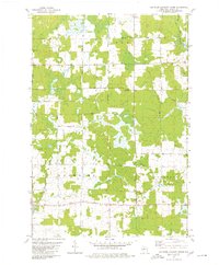
1979 Map of Rib River Lookout Tower
USGS Topo · Published 1980About this map
Greenwood, Browning, and Goodrich intersect in this wooded and agricultural stretch of Taylor County, defined by a complex network of wetlands and small waterways. The Big Rib River cuts through the northeast, while the Little Black River and its East Branch drainage system dominate the central landscape. Local social and educational life in the late 1970s is anchored by landmarks like St Peter Ch, Greenwood Sch, and Cloverdale Sch. The presence of the Rib River Lookout Tower and a Radio Tower suggests the high ground required for early fire spotting and communications. Settlers and farmers here utilized a grid of rural lanes, including Shady Lane Ave and Tamarack Drive, many of which follow section lines through the alternating woodlots and clearings characteristic of central Wisconsin.
Find a feature on this map
30 named features on this map. Tap any name to fly to it.
Don’t see what you’re looking for? This feature index may not catch every label — zoom into the map to look around manually.
Map Details
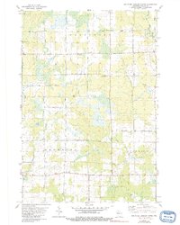
Editions of this 1979 Rib River Lookout Tower Map
2 editions found
Other maps of this area

1902 · Marathon
USGS Topo · 1:125,000

1944 · Ogema
USGS Topo · 1:48,000

1945 · Rib Lake
USGS Topo · 1:48,000

1947 · Rib Lake
USGS Topo · 1:48,000

1947 · Ogema
USGS Topo · 1:48,000

1949 · Ogema
USGS Topo · 1:48,000

1949 · Rib Lake
USGS Topo · 1:48,000

1951 · Athens
USGS Topo · 1:48,000

1951 · Medford
USGS Topo · 1:48,000

1953 · Rice Lake
USGS Topo · 1:250,000