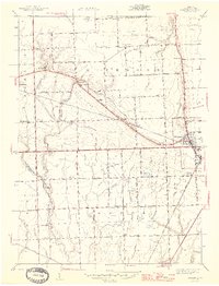
1945 Map of Richmond
USGS Topo · Published 1945About this map
The municipal hub of Richmond and the adjacent settlement of Lenox anchor the eastern landscape of this 1944 survey, where the Grand Trunk Western railroad corridor creates a diagonal axis across the fertile Macomb County terrain. The region is defined by an extensive system of agricultural drainage, including the Norton Drain, Harrison Drain, and Coon Creek, supporting a dense network of family farms and rural homesteads.
Find a feature on this map
49 named features on this map. Tap any name to fly to it.
Don’t see what you’re looking for? This feature index may not catch every label — zoom into the map to look around manually.
Map Details
Editions of this 1945 Richmond Map
2 editions found

Other maps of this area

1912 · Mt Clemens
USGS Topo · 1:62,500

1914 · Armada
USGS Topo · 1:62,500

1914 · Algonac
USGS Topo · 1:62,500

1928 · Armada
USGS Topo · 1:62,500

1928 · Hicky
USGS Topo · 1:62,500

1929 · Mt Clemens
USGS Topo · 1:62,500

1936 · New Haven
USGS Topo · 1:31,680

1936 · Waldenburg
USGS Topo · 1:31,680

1936 · New Baltimore
USGS Topo · 1:31,680

1939 · New Baltimore
USGS Topo · 1:24,000