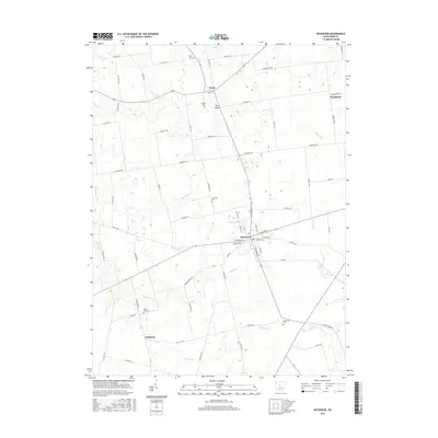
2016 Map of Richwood
USGS Topo · Published 2016About this map
Richwood serves as the central hub of this northern Union County landscape, where the street grid of the village meets the extensive agricultural drainage network of the Central Ohio plains. The town is oriented around Richwood Lake and a series of named runs and creeks, including Peacock Run and Fulton Cr. Small rural settlements like Essex, Woodland, and Claiborne punctuate the landscape, connected by a rigid system of county and township roads that follow the early survey lines. This map is particularly valuable for genealogists, as it preserves the locations of several smaller burial grounds such as Stony Point Cem, Hamilton Cem, and Cheney Cem. The presence of features like Big Swale and Big Swale Cr illustrates the hydrological character of the region, where natural lowlands have been integrated into the local farming and township layout.
Find a feature on this map
73 named features on this map. Tap any name to fly to it.
Don’t see what you’re looking for? This feature index may not catch every label — zoom into the map to look around manually.
Map Details
Editions of this 2016 Richwood Map
This is the sole edition of this map. No revisions or reprints were ever made.
Other maps of this area

1903 · Marion
USGS Topo · 1:62,500

1905 · Marion
USGS Topo · 1:62,500

1913 · Richwood
USGS Topo · 1:62,500

1915 · Richwood
USGS Topo · 1:62,500

1915 · La Rue
USGS Topo · 1:62,500

1924 · Delaware
USGS Topo · 1:62,500

1925 · Delaware
USGS Topo · 1:62,500

1944 · Richwood
USGS Topo · 1:62,500

1944 · Delaware
USGS Topo · 1:62,500

1950 · Marion
USGS Topo · 1:250,000