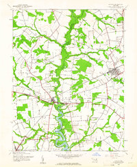
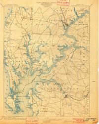
1944 Map of Ridgely
USGS Topo · Published 1961About this map
Tuckahoe Creek carves a winding path through the center of this 1944 survey, serving as a natural boundary between Queen Anne's, Caroline, and Talbot counties. The landscape is defined by the intersection of the Pennsylvania and Baltimore and Eastern railroads, which facilitated the growth of rural hubs like Ridgely and the twin settlements of Queen Anne and Hillsboro. While the lowlands follow the serpentine course of Mason Branch and Norwich Creek, the surrounding upland plains are dotted with long-standing local landmarks such as Allan Ch and Thawleys Chapel. The map documents a period of established agricultural and rail transport, capturing smaller hamlets like Jumptown and Downes before mid-century changes altered the pace of Maryland's Eastern Shore.
Find a feature on this map
25 named features on this map. Tap any name to fly to it.
Don’t see what you’re looking for? This feature index may not catch every label — zoom into the map to look around manually.
Map Details
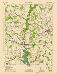
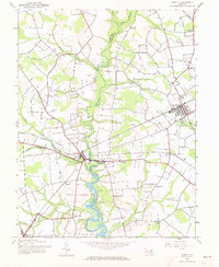
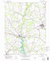
Editions of this 1944 Ridgely Map
4 editions found
Other maps of this area

1898 · Choptank
USGS Topo · 1:125,000

1898 · Tolchester
USGS Topo · 1:125,000

1899 · Dover
USGS Topo · 1:125,000
1901 · Chestertown
USGS Topo · 1:62,500

1903 · Tolchester
USGS Topo · 1:125,000

1904 · St. Michaels
USGS Topo · 1:62,500

1905 · Denton
USGS Topo · 1:62,500
1905 · Barclay
USGS Topo · 1:62,500

1906 · Dover
USGS Topo · 1:125,000

1908 · Tolchester
USGS Topo · 1:125,000