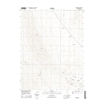
2014 Map of Riepetown
USGS Topo · Published 2014About this map
Kimberly and Riepetown sit within the high-elevation basin of White Pine County, showing the proximity of settlement to the industrial footprints of the region's mining operations. This 2014 survey captures a landscape defined by both natural relief and significant human modification, where the Egan Range towers over features like the Sunshine Dump and Copper Flat. The presence of the Old Lincoln Hwy and Gleason Creek Rd highlights the transportation corridors that historically connected these mountain communities. Water sources in this arid climate are carefully noted, including Giroux Springs, Lyons Spring, and the course of the White River Wash. Terrain features such as Pilot Knob and Robinson Canyon illustrate the complex geography surrounding these towns, providing a detailed record of the physical and cultural geography at the start of the 21st century.
Find a feature on this map
23 named features on this map. Tap any name to fly to it.
Don’t see what you’re looking for? This feature index may not catch every label — zoom into the map to look around manually.
Map Details
Editions of this 2014 Riepetown Map
This is the sole edition of this map. No revisions or reprints were ever made.
Other maps of this area

1952 · Ely
USGS Topo · 1:125,000

1956 · Ely
USGS Topo · 1:250,000

1958 · Ruth
USGS Topo · 1:24,000

1958 · Ely
USGS Topo · 1:62,500

1958 · McGill
USGS Topo · 1:62,500

1958 · Reipetown
USGS Topo · 1:24,000

1958 · Giroux Wash
USGS Topo · 1:24,000

1958 · Ely
USGS Topo · 1:24,000

1959 · Ely
USGS Topo · 1:250,000

1959 · Reipetown
USGS Topo · 1:62,500