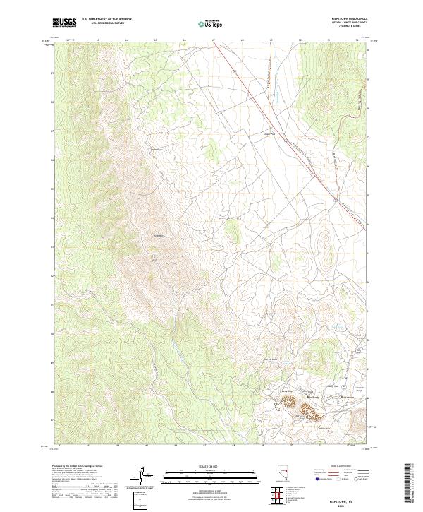
2021 Map of Riepetown
USGS Topo · Published 2021About this map
Kimberly and Riepetown anchor the eastern edge of this landscape, where the modern industrial footprint meets the high desert terrain of the Egan Range. This 2021 survey reveals a complex network of resource extraction and transit, evidenced by the presence of the Sunshine Dump and the winding path of State Hwy 485. The map traces the historical transport corridor of the Old Lincoln Hwy as it cuts through the mountains, providing a clear record of how regional infrastructure has evolved alongside the mining industry.
Find a feature on this map
24 named features on this map. Tap any name to fly to it.
Don’t see what you’re looking for? This feature index may not catch every label — zoom into the map to look around manually.
Map Details
Editions of this 2021 Riepetown Map
This is the sole edition of this map. No revisions or reprints were ever made.
Other maps of this area

1952 · Ely
USGS Topo · 1:125,000

1956 · Ely
USGS Topo · 1:250,000

1958 · Ruth
USGS Topo · 1:24,000

1958 · Ely
USGS Topo · 1:62,500

1958 · McGill
USGS Topo · 1:62,500

1958 · Reipetown
USGS Topo · 1:24,000

1958 · Giroux Wash
USGS Topo · 1:24,000

1958 · Ely
USGS Topo · 1:24,000

1959 · Ely
USGS Topo · 1:250,000

1959 · Reipetown
USGS Topo · 1:62,500