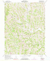
1961 Map of Ringgold
USGS Topo · Published 1990About this map
Ringgold and Elliott Crossroads serve as the primary nodes for this rural Morgan County landscape during the early 1960s. The terrain is defined by a dense network of winding watercourses, including the West Branch Wolf Creek and Federal Creek, which carve through the townships of Union, Homer, and Marion. A significant portion of the area is dedicated to conservation, as seen in the expansive Wolf Creek Wildlife Area.
Find a feature on this map
42 named features on this map. Tap any name to fly to it.
Don’t see what you’re looking for? This feature index may not catch every label — zoom into the map to look around manually.
Map Details
Editions of this 1961 Ringgold Map
4 editions found
Other maps of this area

1903 · Athens
USGS Topo · 1:62,500

1904 · Chesterhill
USGS Topo · 1:62,500

1905 · Athens
USGS Topo · 1:62,500

1906 · Chesterhill
USGS Topo · 1:62,500

1910 · Mc Connelsville
USGS Topo · 1:62,500

1911 · New Lexington
USGS Topo · 1:62,500

1947 · Columbus
USGS Topo · 1:250,000

1949 · Clarksburg
USGS Topo · 1:250,000

1956 · Clarksburg
USGS Topo · 1:250,000

1960 · Amesville
USGS Topo · 1:24,000