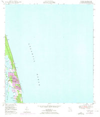
1948 Map of Riomar
USGS Topo · Published 1971About this map
Vero Beach and Riomar occupy the narrow barrier island between the Atlantic Ocean and the Indian River, showcasing the mid-century development of Florida's Treasure Coast. While the 1948 field check captures the early footprint of the Riomar Country Club Golf Course and established roads like Beachland Blvd, 1970 aerial revisions (indicated in purple) reveal significant urban expansion. The intricate network of coastal waterways is a defining feature, including McCullers Cove, Bethel Creek, and the dredged Gifford Cut. To the south, residential growth pushes toward Erwin Cove, though the landscape remains dotted with natural landmarks like Dark Point and the mangrove-lined banks of the Intracoastal Waterway. This survey documents the transition from a sparsely populated coastal strip into a structured resort and residential hub.
Find a feature on this map
27 named features on this map. Tap any name to fly to it.
Don’t see what you’re looking for? This feature index may not catch every label — zoom into the map to look around manually.
Map Details
Editions of this 1948 Riomar Map
4 editions found
Other maps of this area

1948 · Riomar
USGS Topo · 1:24,000

1948 · Indrio
USGS Topo · 1:24,000

1949 · Vero Beach
USGS Topo · 1:24,000

1949 · Sebastian
USGS Topo · 1:24,000

1949 · Oslo
USGS Topo · 1:24,000

1950 · Riomar
USGS Topo · 1:24,000

1950 · Oslo
USGS Topo · 1:24,000

1950 · Indrio
USGS Topo · 1:24,000

1950 · Vero Beach
USGS Topo · 1:24,000

1951 · Sebastian
USGS Topo · 1:24,000