
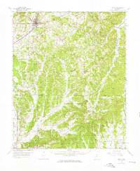
1955 Map of Ripley
USGS Topo · Published 1956About this map
Ripley stands as the primary hub of this 1950s northern Mississippi landscape, where the Gulf Mobile and Ohio railroad corridor dictates the path of commerce and travel. The terrain is defined by the headwaters of several significant drainage systems, including the Hatchie River and the Tallahatchie River, which originate among the numerous ridges such as Sapling Mountain and Pea Ridge. Rural life is anchored by a dense network of country churches and schools, from Academy Ch and Antioch Sch to the Tippah-Union Sch at the county line. The map illustrates a transitional period in land management, featuring the Dumas Lookout Tower for fire observation and localized infrastructure like the Stubb Dam on Rainey Lake. Small settlements like Dumas, Molino, and Keownville serve as vital local landmarks across the rolling hills of the Tippah and Union county border.
Find a feature on this map
150 named features on this map. Tap any name to fly to it.
Don’t see what you’re looking for? This feature index may not catch every label — zoom into the map to look around manually.
Map Details
Editions of this 1955 Ripley Map
2 editions found
Other maps of this area

1921 · Booneville
USGS Topo · 1:48,000

1921 · Tupelo
USGS Topo · 1:48,000

1922 · Booneville
USGS Topo · 1:62,500

1923 · Tupelo
USGS Topo · 1:62,500

1949 · New Albany
USGS Topo · 1:62,500

1950 · Ashland
USGS Topo · 1:62,500

1950 · Corinth
USGS Topo · 1:62,500

1951 · New Albany
USGS Topo · 1:62,500

1951 · Walnut
USGS Topo · 1:62,500

1955 · Sherman
USGS Topo · 1:62,500