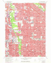
1963 Map of River Forest
USGS Topo · Published 1973About this map
The Des Plaines River corridor serves as the backbone of this mid-century portrait of suburban Cook County, where dense residential grids meet expansive forest preserves and historic institutions. Large tracts of land remain dedicated to a notable concentration of cemeteries, including St Joseph Cemetery, Mount Olive Cemetery, and All Saints Cemetery, which contrast with the rapid post-war expansion in Norridge and Harwood Heights. Higher education and healthcare facilities are prominent landmarks, from the sprawling campus of Concordia College and the neighboring Dominican College to the Chicago State Hospital grounds. The map captures the transportation evolution of the Chicago area, showing the Tri-State Tollway and Kennedy Expressway cutting through established townships like Leyden and Norwood Park. Recreational and social hubs like the Maywood Park Racetrack and numerous wooded preserves such as Schiller Woods South reflect the era's balance of industry, transit, and community space.
Find a feature on this map
133 named features on this map. Tap any name to fly to it.
Don’t see what you’re looking for? This feature index may not catch every label — zoom into the map to look around manually.
Map Details
Editions of this 1963 River Forest Map
4 editions found
Other maps of this area

1889 · Chicago
USGS Topo · 1:62,500

1891 · Chicago
USGS Topo · 1:62,500

1891 · Riverside
USGS Topo · 1:62,500

1893 · Riverside
USGS Topo · 1:62,500

1899 · Evanston
USGS Topo · 1:62,500

1900 · Chicago
USGS Topo · 1:62,500

1900 · Riverside
USGS Topo · 1:62,500

1900 · Highwood
USGS Topo · 1:62,500

1901 · Riverside
USGS Topo · 1:62,500

1901 · Chicago
USGS Topo · 1:62,500