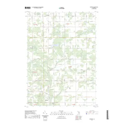
2023 Map of Riverdale
USGS Topo · Published 2023About this map
The Pine River and its numerous tributaries, including the North Branch Pine River and Tyman Branch, define this section of Michigan where Isabella, Montcalm, and Gratiot counties meet. The settlement of Riverdale serves as a primary local hub, complemented by the smaller communities of Elm Hall and Strickland. The landscape is dotted with several small water bodies like Half Moon Lake, LaStrange Lake, and Peterman Lake, reflecting the region's glacial history. Local heritage is preserved in numerous burial grounds, such as Irishtown Cem, French Seville Cem, and Sibley Cem, which are scattered throughout the rural sections. Modern transportation and infrastructure are represented by Hamp Airport and a grid-like network of county roads like Lumberjack Rd and Bliss Rd that facilitate movement between agricultural parcels.
Find a feature on this map
106 named features on this map. Tap any name to fly to it.
Don’t see what you’re looking for? This feature index may not catch every label — zoom into the map to look around manually.
Map Details
Editions of this 2023 Riverdale Map
This is the sole edition of this map. No revisions or reprints were ever made.
Other maps of this area

1916 · Mount Pleasant
USGS Topo · 1:62,500

1919 · Mount Pleasant
USGS Topo · 1:62,500

1930 · Shepherd
USGS Topo · 1:48,000

1935 · Alma
USGS Topo · 1:62,500

1936 · Shepherd
USGS Topo · 1:62,500

1938 · Alma
USGS Topo · 1:62,500

1943 · Mount Pleasant
USGS Topo · 1:62,500

1954 · Midland
USGS Topo · 1:250,000

1958 · Midland
USGS Topo · 1:250,000

1959 · Midland
USGS Topo · 1:250,000