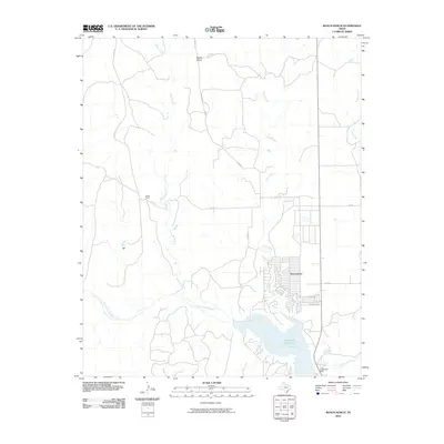
2010 Map of Roach Ranch
USGS Topo · Published 2010About this map
The Howardwick community sits at the heart of this Donley County landscape, established near the significant waters of the Greenbelt Reservoir. This reservoir is formed by the Greenbelt Dam, which impounds the Salt Fork Red River as it flows through the southern portion of the quadrangle. The terrain is defined by a network of drainage systems including Allen Creek, Carrol Creek, and Turkey Creek, all cutting through the high plains. North of the primary settlement, the elevation rises toward Mount Ararat, a prominent local landmark. The namesake Roach Ranch occupies the western portion of the sheet, connected by a rural road network that includes Co RD I and Co RD 7, illustrating the sprawling ranching and residential layout of this Panhandle region in the early 21st century.
Find a feature on this map
15 named features on this map. Tap any name to fly to it.
Don’t see what you’re looking for? This feature index may not catch every label — zoom into the map to look around manually.
Map Details
Editions of this 2010 Roach Ranch Map
This is the sole edition of this map. No revisions or reprints were ever made.
Other maps of this area

1954 · Amarillo
USGS Topo · 1:250,000

1954 · Plainview
USGS Topo · 1:250,000

1958 · Amarillo
USGS Topo · 1:250,000

1958 · Plainview
USGS Topo · 1:250,000

1960 · Groom
USGS Topo · 1:62,500

1962 · Lelia Lake
USGS Topo · 1:24,000

1962 · Roach Ranch
USGS Topo · 1:24,000

1962 · Griffin Ranch
USGS Topo · 1:24,000

1963 · Clarendon
USGS Topo · 1:24,000

1963 · Buffalo Arroyo
USGS Topo · 1:24,000