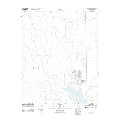
2012 Map of Roach Ranch
USGS Topo · Published 2012About this map
The residential streets of Howardwick cluster along the northern shores of Greenbelt Reservoir in this Donley County landscape. Established as a resort community in the late 20th century, the town's street grid—featuring names like Sailfish Dr, Lubbock Dr, and Dana Dr—reflects its modern development relative to the surrounding open ranch land. To the northwest, the namesake Roach Ranch occupies the high ground between the ephemeral drainages of Allen Cr and Carrol Cr, illustrating the vast, low-density land use typical of the Texas Panhandle.
Find a feature on this map
50 named features on this map. Tap any name to fly to it.
Don’t see what you’re looking for? This feature index may not catch every label — zoom into the map to look around manually.
Map Details
Editions of this 2012 Roach Ranch Map
This is the sole edition of this map. No revisions or reprints were ever made.
Other maps of this area

1954 · Amarillo
USGS Topo · 1:250,000

1954 · Plainview
USGS Topo · 1:250,000

1958 · Amarillo
USGS Topo · 1:250,000

1958 · Plainview
USGS Topo · 1:250,000

1960 · Groom
USGS Topo · 1:62,500

1962 · Lelia Lake
USGS Topo · 1:24,000

1962 · Roach Ranch
USGS Topo · 1:24,000

1962 · Griffin Ranch
USGS Topo · 1:24,000

1963 · Clarendon
USGS Topo · 1:24,000

1963 · Buffalo Arroyo
USGS Topo · 1:24,000