2016 Map of Roach Ranch
USGS Topo · Published 2016About this map
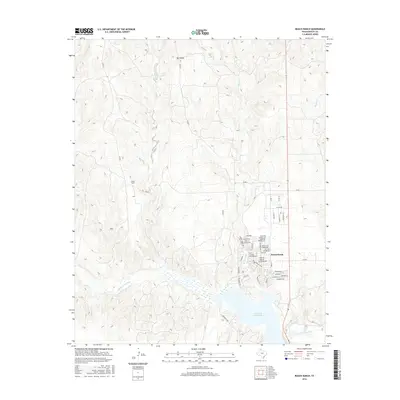
Greenbelt Reservoir dominates the southern landscape of this Donley County region, where the Salt Fork Red River is impounded amidst the breaks of the Texas Panhandle. To the north of the water, the community of Howardwick is laid out with a dense network of residential streets, including Rick Husband Blvd and Olita Dr, serving as a recreational and residential hub for the area. The terrain transitions into open rangeland dominated by the Roach Ranch and the prominent elevation of Mt Ararat. Numerous drainage systems like Allen Cr, Carrol Cr, and Turkey Cr carve through the topography, illustrating the watershed patterns that feed the reservoir. The map documents the persistent ranching footprint alongside modern lakeside development and the critical north-south corridor of Route 70.
Find a feature on this map
45 named features on this map. Tap any name to fly to it.
Don’t see what you’re looking for? This feature index may not catch every label — zoom into the map to look around manually.
Map Details
Editions of this 2016 Roach Ranch Map
This is the sole edition of this map. No revisions or reprints were ever made.
Other maps of this area

1954 · Amarillo
USGS Topo · 1:250,000

1954 · Plainview
USGS Topo · 1:250,000

1958 · Amarillo
USGS Topo · 1:250,000

1958 · Plainview
USGS Topo · 1:250,000

1960 · Groom
USGS Topo · 1:62,500

1962 · Lelia Lake
USGS Topo · 1:24,000

1962 · Roach Ranch
USGS Topo · 1:24,000

1962 · Griffin Ranch
USGS Topo · 1:24,000

1963 · Clarendon
USGS Topo · 1:24,000

1963 · Buffalo Arroyo
USGS Topo · 1:24,000