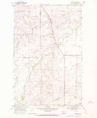
1968 Map of Robere
USGS Topo · Published 1972About this map
The Lewis and Clark Trail cuts through this landscape on the edge of the Blackfeet Indian Reservation Bdy, where the high plains transition between Glacier and Pondera Counties. The map documents the former townsite of Robere, once a notable stop in the region, along with the Robere Cem and the nearby Grandview Sch. This area is defined by a sophisticated network of irrigation infrastructure designed to manage the waters of Birch Creek and Blacktail Creek, including the Ryan Lauffler Ditch and the Kingsbury Ditch. Local community life is centered around landmarks like the Birch Creek Rodeo Ground and the small settlement of Arena. The terrain is marked by distinctive coulees such as Miller Coulee and Cartwright Coulee, which drain the open Flats.
Find a feature on this map
23 named features on this map. Tap any name to fly to it.
Don’t see what you’re looking for? This feature index may not catch every label — zoom into the map to look around manually.
Map Details
Editions of this 1968 Robere Map
2 editions found
Other maps of this area

1914 · Heart Butte
USGS Topo · 1:125,000

1918 · Heart Butte
USGS Topo · 1:125,000

1920 · Dupuyer
USGS Topo · 1:125,000

1934 · Lake Frances
USGS Topo · 1:48,000

1936 · Pendroy
USGS Topo · 1:48,000

1937 · Lake Frances
USGS Topo · 1:62,500

1941 · Pendroy
USGS Topo · 1:62,500

1960 · Cut Bank
USGS Topo · 1:250,000

1963 · Cut Bank
USGS Topo · 1:250,000

1964 · Cut Bank
USGS Topo · 1:250,000