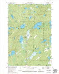
1973 Map of Roberts Lake
USGS Topo · Published 1989About this map
Roberts Lake dominates the central landscape of this 1970s Forest County survey, serving as a primary focal point for the surrounding Nicolet National Forest. The map documents a classic Northwoods environment where water and timber dictate the geography. The Soo Line railroad cuts through the northern section, passing near Eds Lake and providing a historical link to the region's logging and transit past. Small settlements such as Woodlawn and Freedom Corners anchor the rural road network, while the southern reaches are defined by the conservation lands of the Bog Brook State Wildlife Area.
Find a feature on this map
51 named features on this map. Tap any name to fly to it.
Don’t see what you’re looking for? This feature index may not catch every label — zoom into the map to look around manually.
Map Details
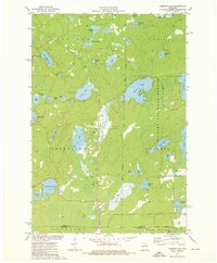
Editions of this 1973 Roberts Lake Map
2 editions found
Other maps of this area

1939 · Crandon
USGS Topo · 1:48,000

1939 · Laona
USGS Topo · 1:48,000

1941 · Crandon
USGS Topo · 1:48,000

1942 · Wabeno
USGS Topo · 1:48,000

1942 · Pearson
USGS Topo · 1:48,000

1946 · Laona
USGS Topo · 1:48,000

1947 · Crandon
USGS Topo · 1:48,000

1950 · Wabeno
USGS Topo · 1:48,000

1950 · Lily
USGS Topo · 1:48,000

1951 · Wabeno
USGS Topo · 1:48,000