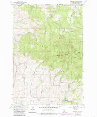
1960 Map of Robinson Lake
USGS Topo · Published 1985About this map
Palouse Range peaks dominate this Latah County landscape, anchored by the high elevations of West Twin and East Twin. The topography here reflects a complex transition from high ridges to fertile drainages, including the headwaters of the South Fork Palouse River and the meandering path of Paradise Creek. Significant land use is evident in the northern section, where the University of Idaho Experimental Forest covers large tracts of timbered terrain. Historically, the area supported a mix of resource extraction and conservation, evidenced by the White Cross Mine tucked between the ridges and the recreational presence of Robinson Lake. A series of Radio Relay Stations atop the summits and the prominent Rocky Point Lookout suggest a landscape valued for its line-of-sight utility and forest management during the mid-20th century.
Find a feature on this map
27 named features on this map. Tap any name to fly to it.
Don’t see what you’re looking for? This feature index may not catch every label — zoom into the map to look around manually.
Map Details
Editions of this 1960 Robinson Lake Map
3 editions found
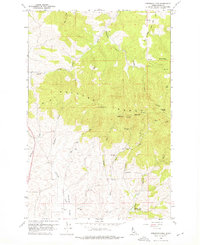
Other maps of this area

1910 · Pullman
USGS Topo · 1:125,000

1955 · Pullman
USGS Topo · 1:250,000

1958 · Pullman
USGS Topo · 1:250,000

1960 · Troy
USGS Topo · 1:24,000

1960 · Robinson Lake
USGS Topo · 1:24,000

1960 · Moscow Mtn
USGS Topo · 1:24,000

1960 · Moscow East
USGS Topo · 1:24,000

1960 · Potlatch
USGS Topo · 1:62,500

1961 · Moscow
USGS Topo · 1:62,500

1964 · Viola
USGS Topo · 1:24,000