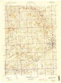
1945 Map of Rochester
USGS Topo · Published 1945About this map
Bald Mtn rises above a landscape of small glacial lakes and emerging suburbs in this 1940s survey. The area transitions from the rural clusters of Goodison and Oak Grove toward the growing village center of Rochester, where the Grand Trunk Western RR facilitates local industry and transport. Public life is anchored by a dense network of country schoolhouses, including Five Points Sch, Willis Sch, and Hubble Sch, many of which served as local landmarks for families before the post-war consolidation of districts.
Find a feature on this map
53 named features on this map. Tap any name to fly to it.
Don’t see what you’re looking for? This feature index may not catch every label — zoom into the map to look around manually.
Map Details
Editions of this 1945 Rochester Map
2 editions found
Other maps of this area

1907 · Pontiac
USGS Topo · 1:62,500

1908 · Rochester
USGS Topo · 1:62,500

1936 · Warren
USGS Topo · 1:31,680

1936 · Birmingham
USGS Topo · 1:31,680

1936 · Rochester
USGS Topo · 1:31,680

1936 · Washington
USGS Topo · 1:31,680

1936 · Pontiac South
USGS Topo · 1:31,680

1936 · Pontiac North
USGS Topo · 1:31,680

1943 · Pontiac South
USGS Topo · 1:24,000

1943 · Pontiac North
USGS Topo · 1:24,000
Featured Places
- Rochester Hills, MI
- Pontiac, MI
- Orion Charter Township, MI
- Auburn Hills, MI
- Oakland Charter Township, MI