
1968 Map of Rock Camp
USGS Topo · Published 1971About this map
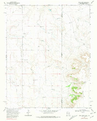
The high plains of the Llano Estacado define this borderland where New Mexico meets the Texas Panhandle. In the late 1960s, the landscape was dominated by ranching infrastructure, evidenced by a network of family-named water sources and ranch sites. Landmarks like Brown Windmill, Peters Windmill, and Chandler Windmills provided vital water for livestock across the arid terrain. The map captures the remote operations of the Bowe Ranch and Purcell Ranch, alongside the localized headquarters at South Headquarters and the namesake Rock Camp. Drainage patterns are marked by seasonal features such as Arroyo del Puerto and Arroyo Trujillo, which cut through the level surface toward the more dramatic topography of Sand Point Draw. This survey serves as a precise record of the mid-century cattle economy and the specific placement of windmills that sustained it before modern irrigation shifts.
Find a feature on this map
24 named features on this map. Tap any name to fly to it.
Don’t see what you’re looking for? This feature index may not catch every label — zoom into the map to look around manually.
Map Details
Editions of this 1968 Rock Camp Map
3 editions found
Other maps of this area

1954 · Tucumcari
USGS Topo · 1:250,000

1954 · Clovis
USGS Topo · 1:250,000

1958 · Clovis
USGS Topo · 1:250,000

1958 · Tucumcari
USGS Topo · 1:250,000

1966 · Moser Ranch
USGS Topo · 1:24,000

1966 · Sand Point
USGS Topo · 1:24,000

1968 · Riley Camp
USGS Topo · 1:24,000

1968 · Bard
USGS Topo · 1:24,000

1968 · Glenrio
USGS Topo · 1:24,000

1971 · Mustang Lake
USGS Topo · 1:24,000