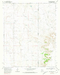
1968 Map of Rock Camp
USGS Topo · Published 1981About this map
The high plains landscape along the New Mexico and Texas border is defined here by a network of ranching outposts and vital water sources. Surveyed in the late 1960s, this area spans the Quay County and Deaf Smith County line, where the terrain transitions toward the canyon breaks of Sand Point Draw. Large-scale cattle operations are evidenced by the presence of Bowe Ranch and Purcell Ranch, supported by a sophisticated system of named water points including Love Windmill, Reeves Windmill, and Chandler Windmills.
Find a feature on this map
24 named features on this map. Tap any name to fly to it.
Don’t see what you’re looking for? This feature index may not catch every label — zoom into the map to look around manually.
Map Details
Editions of this 1968 Rock Camp Map
3 editions found
Other maps of this area

1954 · Tucumcari
USGS Topo · 1:250,000

1954 · Clovis
USGS Topo · 1:250,000

1958 · Clovis
USGS Topo · 1:250,000

1958 · Tucumcari
USGS Topo · 1:250,000

1966 · Moser Ranch
USGS Topo · 1:24,000

1966 · Sand Point
USGS Topo · 1:24,000

1968 · Rock Camp
USGS Topo · 1:24,000

1968 · Riley Camp
USGS Topo · 1:24,000

1968 · Bard
USGS Topo · 1:24,000

1968 · Glenrio
USGS Topo · 1:24,000