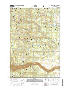
2014 Map of Rock Creek Reservoir
USGS Topo · Published 2014About this map
Mount Hood National Forest dominates this section of Wasco County, where the historic Barlow Rd traces a path through the southern half of the quadrangle. This route, a significant overland passage, is surrounded by a network of drainage systems and reservoirs including Rock Cr Reservoir, Smarts Reservoir, and Miller Reservoir. The map illustrates the complex water management of the region, featuring both the Threemile Ditch and Lost Boulder Ditch alongside natural features like Immigrant Spring and Washburn Spring. The terrain transitions from higher elevations at Boulder Point and Bus Point down into named valleys and clearings such as Hazel Hollow and Smock Prairie. Timber and transport history is evident in the naming of roads like Wamic Mill Rd and Linns Mill Rd, which connect the forest interior to the surrounding area.
Find a feature on this map
40 named features on this map. Tap any name to fly to it.
Don’t see what you’re looking for? This feature index may not catch every label — zoom into the map to look around manually.
Map Details
Editions of this 2014 Rock Creek Reservoir Map
This is the sole edition of this map. No revisions or reprints were ever made.
Other maps of this area

1924 · Mount Hood
USGS Topo · 1:125,000

1927 · Mount Hood
USGS Topo · 1:125,000

1930 · Dufur
USGS Topo · 1:125,000

1934 · Dufur
USGS Topo · 1:125,000

1953 · The Dalles
USGS Topo · 1:250,000

1956 · The Dalles
USGS Topo · 1:250,000

1956 · Mt. Wilson
USGS Topo · 1:62,500

1957 · The Dalles
USGS Topo · 1:250,000

1962 · Rock Creek Reservoir
USGS Topo · 1:24,000
1962 · Foreman Point
USGS Topo · 1:24,000