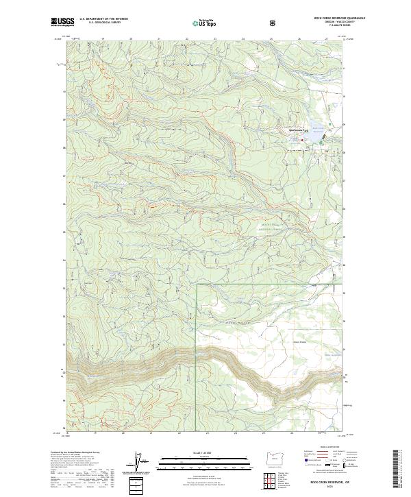
2023 Map of Rock Creek Reservoir
USGS Topo · Published 2023About this map
The Mount Hood National Forest dominates this section of north-central Oregon, where high-country drainage systems meet a complex network of forest trails and water management infrastructure. The landscape is defined by the steep descent of the White River and the White Wild and Scenic River corridor along the southern edge, while the northern portion focuses on the recreational and utility waters of Rock Creek Reservoir and Smarts Reservoir. Near Sportsmans Park, a sophisticated system of manual water diversion is evident through features like the Threemile Ditch and Lost Boulder Ditch, which channel mountain runoff through the timbered slopes. The map also records several specific high points and clearings such as Bus Point, Clear Point, and Smock Prairie, alongside numerous family-named or historic trail routes including the Mccubbins 588 Mineral Jane Trl.
Find a feature on this map
56 named features on this map. Tap any name to fly to it.
Don’t see what you’re looking for? This feature index may not catch every label — zoom into the map to look around manually.
Map Details
Editions of this 2023 Rock Creek Reservoir Map
This is the sole edition of this map. No revisions or reprints were ever made.
Other maps of this area

1924 · Mount Hood
USGS Topo · 1:125,000

1927 · Mount Hood
USGS Topo · 1:125,000

1930 · Dufur
USGS Topo · 1:125,000

1934 · Dufur
USGS Topo · 1:125,000

1953 · The Dalles
USGS Topo · 1:250,000

1956 · The Dalles
USGS Topo · 1:250,000

1956 · Mt. Wilson
USGS Topo · 1:62,500

1957 · The Dalles
USGS Topo · 1:250,000

1962 · Rock Creek Reservoir
USGS Topo · 1:24,000
1962 · Foreman Point
USGS Topo · 1:24,000