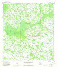
1960 Map of Rock Ridge
USGS Topo · Published 1981About this map
Withlacoochee River Swamp dominates this Central Florida landscape where Polk, Lake, and Sumter counties converge. This mid-century survey reveals a territory defined by hydrologic patterns and early transportation corridors through the wetlands. The small settlement of Rock Ridge serves as the primary upland anchor, situated near the Little Flock Ch and a Fish Hatchery. The map captures a transition in land use, showing multiple segments of Old Railroad Grade and the Main Line Road cutting through the hammocks and drains. These features, along with Hart Hammock and Strand Hammock, suggest a history of timber extraction and drainage efforts typical of the region's development. The intricate network of seasonal watercourses, including Mattress Drain and Cumbree Drain, provides a clear view of the natural drainage flowing toward the Withlacoochee River.
Find a feature on this map
17 named features on this map. Tap any name to fly to it.
Don’t see what you’re looking for? This feature index may not catch every label — zoom into the map to look around manually.
Map Details
Editions of this 1960 Rock Ridge Map
4 editions found
Other maps of this area

1944 · Providence
USGS Topo · 1:31,680

1944 · Polk City
USGS Topo · 1:31,680

1944 · Socrum
USGS Topo · 1:31,680

1955 · Plant City
USGS Topo · 1:250,000

1955 · Orlando
USGS Topo · 1:250,000

1957 · Orlando
USGS Topo · 1:250,000

1958 · Orlando
USGS Topo · 1:250,000

1958 · Plant City
USGS Topo · 1:250,000

1959 · Plant City
USGS Topo · 1:250,000

1959 · Lake Nellie
USGS Topo · 1:24,000