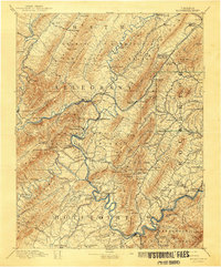
1894 Map of Rockbridge
USGS Topo · Published 1943About this map
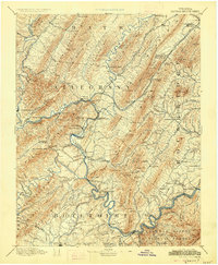
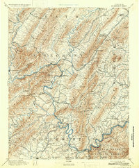
Industrial iron production and river-valley transport define this late-19th-century landscape across Botetourt, Alleghany, and Rockbridge counties. The prominence of iron furnaces such as Long Dale Furnace, Princess Furnace, and Salisbury Furnace highlights the region's metallurgical heritage, while the Chesapeake and Ohio Railroad follows the winding paths of the Jackson River and James River to serve these operations. Topographic detail captures the steep elevations of Rich Patch Mountain and Purgatory Mountain, which hem in established settlements like Clifton Forge, Fincastle, and Buchanan. Local travel patterns of the era are preserved through features like the Lick Run Ferry and the network of local mills, including Kyles Mill and Waskeys Mill P.O., which supported the agrarian communities between the mountain ridges. The map also documents the early footprint of the Natural Bridge vicinity, showing the area before modern commercial development fully transformed the surrounding terrain.
Find a feature on this map
150 named features on this map. Tap any name to fly to it.
Don’t see what you’re looking for? This feature index may not catch every label — zoom into the map to look around manually.
Map Details
Editions of this 1894 Rockbridge Map
7 editions found
Other maps of this area

1887 · Lewisburg
USGS Topo · 1:125,000

1890 · Roanoke
USGS Topo · 1:125,000

1890 · Christiansburg
USGS Topo · 1:125,000

1891 · Roanoke
USGS Topo · 1:125,000

1891 · Lewisburg
USGS Topo · 1:125,000

1891 · Huntersville
USGS Topo · 1:125,000

1892 · Lynchburg
USGS Topo · 1:125,000

1894 · Huntersville
USGS Topo · 1:125,000

1894 · Staunton
USGS Topo · 1:125,000

1894 · Natural Bridge
USGS Topo · 1:125,000