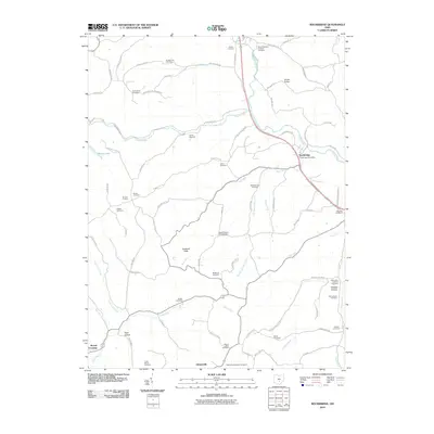
2010 Map of Rockbridge
USGS Topo · Published 2010About this map
Rockbridge and its surrounding rural townships are defined by a complex network of waterways and a dense concentration of historical burial sites. The Hocking River flows through the northeast, while the landscape to the south is carved by Buck Run, Clear Fork, and Laurel Run. The area's deep geological history is evident at Cantwell Cliffs, a significant natural feature near the center of the sheet. Smaller settlements like Gibsonville, Toad Hollow, and Mound Crossing illustrate the traditional crossroads development pattern of this portion of Fairfield County. This survey is particularly valuable for genealogical research, documenting numerous family-named and denominational cemeteries, including the Old Catholic Cemetery, McBroom Cemetery, and Hansen Cemetery. The presence of the Rockbridge Post Office and Camp Wyandot indicates the sustained community and recreational use of this wooded terrain into the early 21st century.
Find a feature on this map
88 named features on this map. Tap any name to fly to it.
Don’t see what you’re looking for? This feature index may not catch every label — zoom into the map to look around manually.
Map Details
Editions of this 2010 Rockbridge Map
This is the sole edition of this map. No revisions or reprints were ever made.
Other maps of this area

1904 · Zaleski
USGS Topo · 1:62,500

1907 · Zaleski
USGS Topo · 1:62,500

1907 · Logan
USGS Topo · 1:62,500

1907 · Lancaster
USGS Topo · 1:62,500

1909 · Lancaster
USGS Topo · 1:62,500

1909 · Logan
USGS Topo · 1:62,500

1910 · Laurelville
USGS Topo · 1:62,500

1912 · Laurelville
USGS Topo · 1:62,500

1944 · Laurelville
USGS Topo · 1:62,500

1947 · Columbus
USGS Topo · 1:250,000