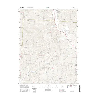
2016 Map of Rockbridge
USGS Topo · Published 2016About this map
Sugar Grove and Rockbridge serve as the primary hubs in this Fairfield and Hocking County landscape, where the Hocking River cuts a path through the sandstone-rich terrain of southern Ohio. The topography is defined by deep hollows and sharp rises, notably at Cantwell Cliffs, a significant geological feature in the southern portion of the sheet. Smaller drainage systems like Buck Run, Clear Creek, and Laurel Run thread through the hills, creating the isolated valleys that characterize local life.
Find a feature on this map
148 named features on this map. Tap any name to fly to it.
Don’t see what you’re looking for? This feature index may not catch every label — zoom into the map to look around manually.
Map Details
Editions of this 2016 Rockbridge Map
This is the sole edition of this map. No revisions or reprints were ever made.
Other maps of this area

1904 · Zaleski
USGS Topo · 1:62,500

1907 · Zaleski
USGS Topo · 1:62,500

1907 · Logan
USGS Topo · 1:62,500

1907 · Lancaster
USGS Topo · 1:62,500

1909 · Lancaster
USGS Topo · 1:62,500

1909 · Logan
USGS Topo · 1:62,500

1910 · Laurelville
USGS Topo · 1:62,500

1912 · Laurelville
USGS Topo · 1:62,500

1944 · Laurelville
USGS Topo · 1:62,500

1947 · Columbus
USGS Topo · 1:250,000