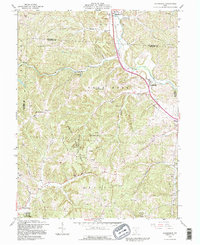
1992 Map of Rockbridge
USGS Topo · Published 1995About this map
Hocking Hills State Park anchors this portion of Hocking County, where the terrain is carved by the Hocking River and its numerous tributaries like Clear Creek and Buck Run. The landscape is a mix of protected forest lands and agricultural valleys, dotted with gas production sites and small rural crossroads. Significant historical markers include many family and community burial grounds, such as the Whippoorwill Cem, McBroom Cem, and Nihizer Cem, which provide valuable location data for genealogists tracking early settlers in Good Hope and Laurel townships. Landmarks like the Cantwell Cliffs and the Lookout Tower near the Fairfield County line highlight the area's natural topography. The settlement at Rockbridge and the southern edge of Sugar Grove show the concentrated development along the primary river corridor, contrasted by isolated rural structures like Pisgah Ch and Union Ch deeper in the hills.
Find a feature on this map
44 named features on this map. Tap any name to fly to it.
Don’t see what you’re looking for? This feature index may not catch every label — zoom into the map to look around manually.
Map Details
Editions of this 1992 Rockbridge Map
This is the sole edition of this map. No revisions or reprints were ever made.
Other maps of this area

1904 · Zaleski
USGS Topo · 1:62,500

1907 · Zaleski
USGS Topo · 1:62,500

1907 · Logan
USGS Topo · 1:62,500

1907 · Lancaster
USGS Topo · 1:62,500

1909 · Lancaster
USGS Topo · 1:62,500

1909 · Logan
USGS Topo · 1:62,500

1910 · Laurelville
USGS Topo · 1:62,500

1912 · Laurelville
USGS Topo · 1:62,500

1944 · Laurelville
USGS Topo · 1:62,500

1947 · Columbus
USGS Topo · 1:250,000