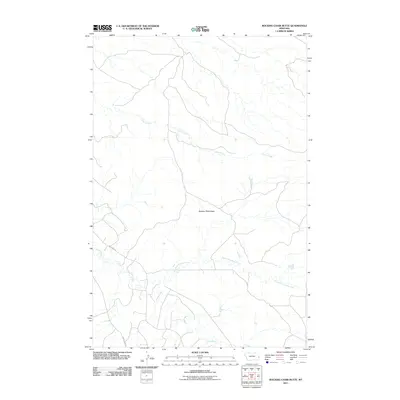
2011 Map of Rocking Chair Butte
USGS Topo · Published 2011About this map
Rocking Chair Butte dominates the central landscape of this Fallon County region, serving as a primary landmark in a terrain defined by its complex drainage systems. The northern portion of the map is etched by the meandering path of Cedar Creek, while the southern expanse is shaped by the confluence and branches of Cabin Creek and the North Fork Cabin Creek. This 2011 survey reveals a landscape largely dedicated to rangeland and resource management, where human presence is primarily marked by specialized infrastructure like Anticline Rd and Cabin Creek Rd. The road network and drainage patterns suggest a high-plains environment where water sources and topographic rises like the butte dictate the movement of both local traffic and natural runoff.
Find a feature on this map
6 named features on this map. Tap any name to fly to it.
Don’t see what you’re looking for? This feature index may not catch every label — zoom into the map to look around manually.
Map Details
Editions of this 2011 Rocking Chair Butte Map
This is the sole edition of this map. No revisions or reprints were ever made.
Other maps of this area

1953 · Miles City
USGS Topo · 1:250,000

1957 · Miles City
USGS Topo · 1:250,000

1958 · Miles City
USGS Topo · 1:250,000

1981 · Lawrence Creek East
USGS Topo · 1:24,000

1981 · Lawrence Creek West
USGS Topo · 1:24,000

1981 · Ayer Spring NE
USGS Topo · 1:24,000

1981 · Cap Rock
USGS Topo · 1:24,000

1981 · Rocking Chair Butte
USGS Topo · 1:24,000
1981 · Rush Hall Reservoir
USGS Topo · 1:24,000

1981 · Wibaux
USGS Topo · 1:100,000