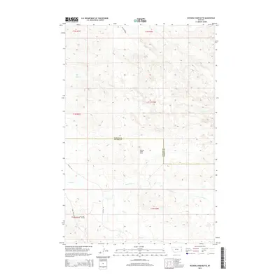
2014 Map of Rocking Chair Butte
USGS Topo · Published 2014About this map
Rocking Chair Butte stands as a central topographic landmark in this section of eastern Montana, where the jurisdictional boundary between Fallon and Wibaux counties cuts through the landscape. The area is defined by the energy industry and drainage networks, most notably the Cabin Creek Oil Field situated in the southwestern corner. This industrial footprint is supported by a specialized road network including Anticline Rd and Cabin Creek Loop, reflecting the region's reliance on geological extraction. Waterways like Cedar Cr, Cabin Cr, and the N Fork Cabin Cr carve through the terrain, illustrating the natural drainage patterns that have influenced land use and ranching access in this part of the plains.
Find a feature on this map
16 named features on this map. Tap any name to fly to it.
Don’t see what you’re looking for? This feature index may not catch every label — zoom into the map to look around manually.
Map Details
Editions of this 2014 Rocking Chair Butte Map
This is the sole edition of this map. No revisions or reprints were ever made.
Other maps of this area

1953 · Miles City
USGS Topo · 1:250,000

1957 · Miles City
USGS Topo · 1:250,000

1958 · Miles City
USGS Topo · 1:250,000

1981 · Lawrence Creek East
USGS Topo · 1:24,000

1981 · Lawrence Creek West
USGS Topo · 1:24,000

1981 · Ayer Spring NE
USGS Topo · 1:24,000

1981 · Cap Rock
USGS Topo · 1:24,000

1981 · Rocking Chair Butte
USGS Topo · 1:24,000
1981 · Rush Hall Reservoir
USGS Topo · 1:24,000

1981 · Wibaux
USGS Topo · 1:100,000