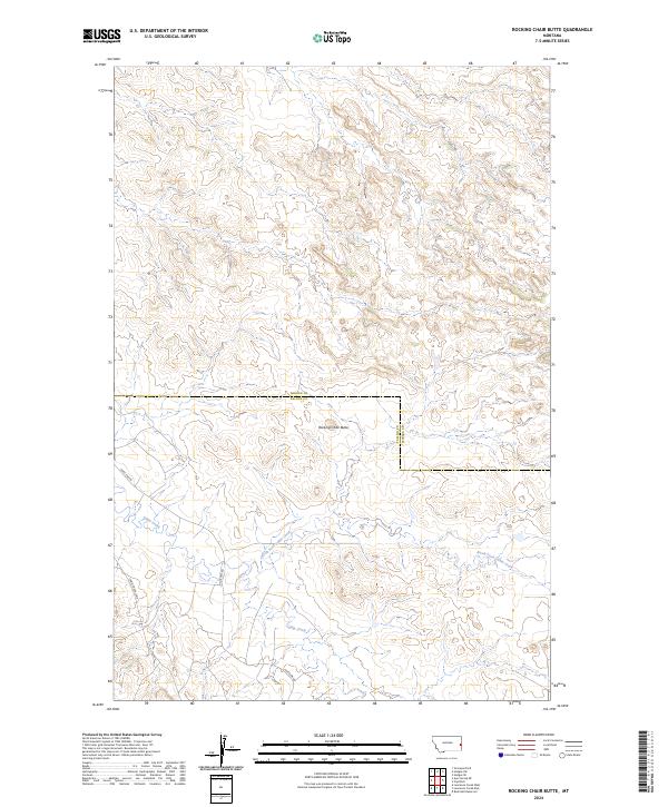
2024 Map of Rocking Chair Butte
USGS Topo · Published 2024About this map
Rocking Chair Butte dominates the central landscape of this western prairie region along the border of Wibaux and Fallon counties. The terrain is defined by the drainage networks of Cabin Creek and the North Fork Cabin Creek, which carve winding paths through the elevation contours. This modern survey reflects a land primarily organized by the Public Land Survey System, with township and range lines such as t11n r58e and t12n r57e dictating the rural grid. Human activity is largely concentrated along sparse transportation routes like Anticline Rd and Cabin Creek Loop, which provide access to this open ranching or energy-producing country. The map captures the subtle intersection of natural hydrology and man-made boundaries in a corner of Montana where the wide-open landscape remains the primary feature.
Find a feature on this map
13 named features on this map. Tap any name to fly to it.
Don’t see what you’re looking for? This feature index may not catch every label — zoom into the map to look around manually.
Map Details
Editions of this 2024 Rocking Chair Butte Map
This is the sole edition of this map. No revisions or reprints were ever made.
Other maps of this area

1953 · Miles City
USGS Topo · 1:250,000

1957 · Miles City
USGS Topo · 1:250,000

1958 · Miles City
USGS Topo · 1:250,000

1981 · Lawrence Creek East
USGS Topo · 1:24,000

1981 · Lawrence Creek West
USGS Topo · 1:24,000

1981 · Ayer Spring NE
USGS Topo · 1:24,000

1981 · Cap Rock
USGS Topo · 1:24,000

1981 · Rocking Chair Butte
USGS Topo · 1:24,000
1981 · Rush Hall Reservoir
USGS Topo · 1:24,000

1981 · Wibaux
USGS Topo · 1:100,000