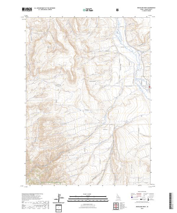
2024 Map of Rockland West
USGS Topo · Published 2024About this map
Rockland Valley serves as a central corridor for water and transportation in this portion of Power County, where the eastern slopes of the Sublett Range descend toward a network of irrigation ditches and creeks. This modern landscape is defined by its hybrid water systems, where natural flows like South Fork Rock Creek and Warm Springs Creek are managed alongside the US Ditch and Lower West Ditch to support agricultural life. Evidence of long-standing ranching and local settlement is visible in the network of family-named roads, including Nelson Ln, Halling Rd, and Christensen Rd, which trace the base of the foothills.
Find a feature on this map
49 named features on this map. Tap any name to fly to it.
Don’t see what you’re looking for? This feature index may not catch every label — zoom into the map to look around manually.
Map Details
Editions of this 2024 Rockland West Map
This is the sole edition of this map. No revisions or reprints were ever made.
Other maps of this area

1934 · Rockland
USGS Topo · 1:62,500

1937 · Rockland
USGS Topo · 1:62,500

1954 · Pocatello
USGS Topo · 1:250,000

1958 · Pocatello
USGS Topo · 1:250,000

1958 · Sublett
USGS Topo · 1:62,500

1959 · Yale
USGS Topo · 1:62,500

1971 · Rockland East
USGS Topo · 1:24,000
1971 · Indian Springs
USGS Topo · 1:24,000
1971 · Neeley
USGS Topo · 1:24,000

1971 · Rockland West
USGS Topo · 1:24,000