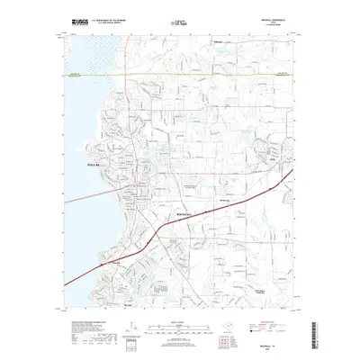
2019 Map of Rockwall
USGS Topo · Published 2019About this map
Rockwall and its eastern suburbs are shown during a period of significant expansion, where the traditional agricultural landscape of the Texas Blackland Prairies meets growing lakeside developments. The shoreline of Corder Lake dominates the western edge of the quadrangle, influencing the street patterns of Glen Hill and Heath. Significant aviation infrastructure is present at the Ralph M Hall/Rockwall Municipal Airport, while the area's rural roots remain visible in local landmarks like Fredonia Hill and smaller water bodies such as Stodghill Lake and Lofland Lake.
Find a feature on this map
264 named features on this map. Tap any name to fly to it.
Don’t see what you’re looking for? This feature index may not catch every label — zoom into the map to look around manually.
Map Details
Editions of this 2019 Rockwall Map
This is the sole edition of this map. No revisions or reprints were ever made.
Other maps of this area

1891 · Dallas
USGS Topo · 1:125,000

1893 · Dallas
USGS Topo · 1:125,000

1912 · Rockwall
USGS Topo · 1:31,680

1919 · Royse City
USGS Topo · 1:62,500

1924 · Farmersville 3-c
USGS Topo · 1:48,000

1924 · Mc Kinney 4-d
USGS Topo · 1:48,000

1929 · McKinney
USGS Topo · 1:62,500

1930 · Farmersville
USGS Topo · 1:62,500

1954 · Dallas
USGS Topo · 1:250,000

1954 · Sherman
USGS Topo · 1:250,000