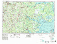
1953 Map of Rocky Mount
USGS Topo · Published 1984About this map
Rocky Mount and the industrial corridors of Eastern North Carolina are detailed in this regional 1:250,000 scale survey, which integrates land topography with extensive bathymetric data of the sounds. The landscape is defined by the massive drainage basins of the Tar River, Roanoke River, and Neuse River, which flow toward the vast, shallow waters of Albemarle Sound and Pamlico Sound. Inland, the map reveals a heavy reliance on rail infrastructure, with the Seaboard Coast Line and Norfolk Southern connecting hubs like Wilson, Greenville, and Goldsboro.
Find a feature on this map
66 named features on this map. Tap any name to fly to it.
Don’t see what you’re looking for? This feature index may not catch every label — zoom into the map to look around manually.
Map Details
Editions of this 1953 Rocky Mount Map
4 editions found

Other maps of this area

1901 · New Bern
USGS Topo · 1:62,500

1901 · Parmele
USGS Topo · 1:62,500

1901 · Williamston
USGS Topo · 1:62,500

1902 · Kenly
USGS Topo · 1:62,500

1902 · Williamston
USGS Topo · 1:62,500

1902 · Parmele
USGS Topo · 1:62,500

1902 · Ayden
USGS Topo · 1:62,500

1902 · Rocky Mount
USGS Topo · 1:62,500

1902 · Spring Hope
USGS Topo · 1:62,500

1902 · Vanceboro
USGS Topo · 1:62,500