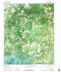
1970 Map of Rocky Point
USGS Topo · Published 1992About this map
The Northeast Cape Fear River defines the southern reach of this landscape, where the boundary between Pender Co and New Hanover Co follows the winding water. Moving north into Pender County, the settlement pattern reveals a cluster of rural communities and family-named localities such as Bells Crossroads, High Smith, and Little Kelly. These areas are anchored by several local congregations, including Rileys Creek Ch and Friendship Ch, which served as social hubs for the surrounding farmsteads.
Find a feature on this map
30 named features on this map. Tap any name to fly to it.
Don’t see what you’re looking for? This feature index may not catch every label — zoom into the map to look around manually.
Map Details
Editions of this 1970 Rocky Point Map
2 editions found
Other maps of this area

1942 · Burgaw
USGS Topo · 1:62,500

1947 · Rocky Point
USGS Topo · 1:62,500

1953 · Florence
USGS Topo · 1:250,000

1953 · Beaufort
USGS Topo · 1:250,000

1954 · Florence
USGS Topo · 1:250,000

1954 · Beaufort
USGS Topo · 1:250,000

1954 · Acme
USGS Topo · 1:62,500

1955 · Atkinson
USGS Topo · 1:62,500

1970 · Scotts Hill
USGS Topo · 1:24,000
1970 · Castle Hayne
USGS Topo · 1:24,000